Today
–
Loading gauge …

Sounds crazy. Could become reality. A standing surf wave in the river Rems – sustainable, regional, shared.
Drag the slider in the picture: this is what the site looks like today – and what it could look like.
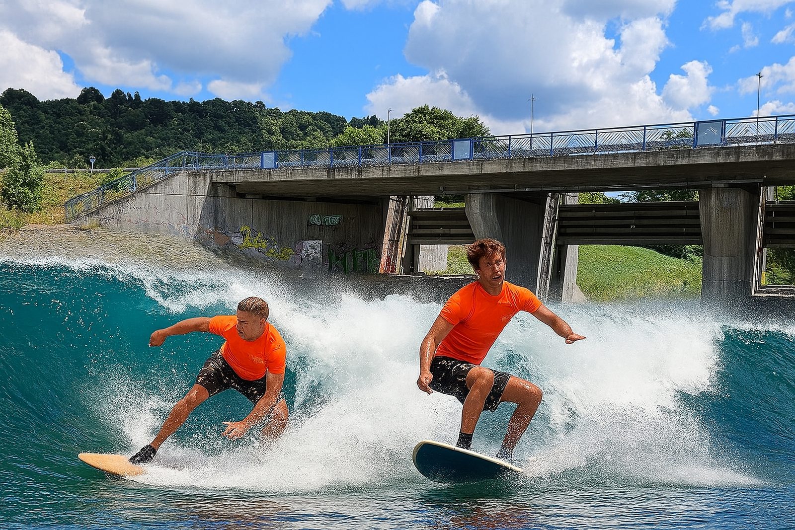
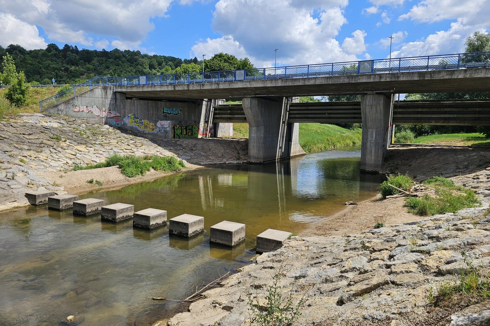 Visualisation · Remswehr Winterbach
That is how often the Remswelle could have been running since the idea went public in May 2025. Counted from 18 May 2025 from the daily values of the Schorndorf gauge, based on our assumption of 3–15 m³/s (Big Day 10–15). The wave does not exist yet. How we calculate →
Not yet a decision to build. First we want to find out whether a safe, ecologically sound and economically reasonable river wave is feasible at the existing structure at all.
As of September 2026 · Roadmap and news
Wave preview · model
At the sea, swell, tide and wind decide whether it's working. On a river, the water level decides. The wave does not exist yet – but the Rems does, and its gauge tells us every day whether a wave would be standing today. Live from the Schorndorf state gauge, plus weather and wind for Winterbach.
–
Loading gauge …
–
Loading gauge …
–
Loading gauge …
Small wave
3.8 m³/s ·
Big Day
11.4 m³/s ·
 Today would be a Big Day at the Remswelle: at the Schorndorf gauge. The wave does not exist yet – yet.
46 surfable days in 2026 up to 24 September – on average there would have been 112 by then. 5 of them Big Days.
The season is coming. After 24 September it takes 7 days on average until the next surfable day; October brings 8 surfable days on average, November 12 – calculated from the years 1996 to 2025.
The year on the Rems: surfable days per month
Average 1996–2025, window 3–15 m³/s. Full wind and climate calendar →
For us, surfable means 3 to 15 m³/s, a Big Day 10 to 15 – an assumption from our analysis of 90 years of gauge data, not the feasibility study. For tomorrow and the day after we only show the trend from the Schwäbisch Gmünd gauge and the rain. Data: Flood Forecasting Centre Baden-Württemberg (Schorndorf gauge, unverified raw data) and Open-Meteo. How we calculated · Official forecast Schorndorf-Bauhof (HVZ) (opens in a new tab) · Privacy (German)
Discover
Three ways to get to know the Rems and Winterbach anew: through crazy questions, through a surfer's eye for terrain and through a search in old files.
 “Could we use the Monopteros as a lighthouse some day?”
Questions nobody else asks – and serious answers to them. For children, parents and anyone who likes to be amazed.
To Anna's questions →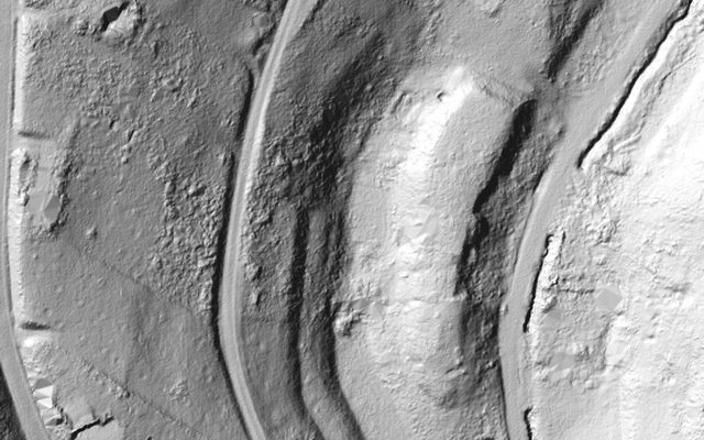 What does the terrain reveal when you take away the forest?
Terrain model, the 1832 field map, aerial photos: the way surfers read spots, we read the Rems valley – with surprising finds.
Our method →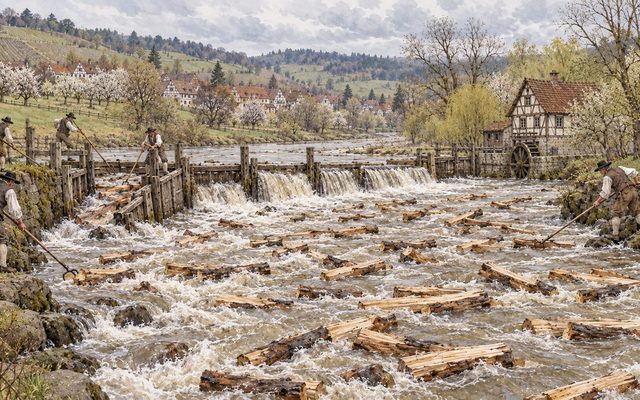 Was there a wave here 200 years ago?
Timber drifting, flushing ponds and the rafting chute in the old mill weir – a search in five chapters. (Picture: illustration)
To the search →More flow for the Rems
A wave does not need as much water as possible at once, but enough of it for as long as possible. Whether the Rems flows evenly or in peaks is decided not at the riverbank but in the landscape upstream: in woods, meadows, vineyards and soils. That is why we, as surfers, look at the whole valley – including its history.
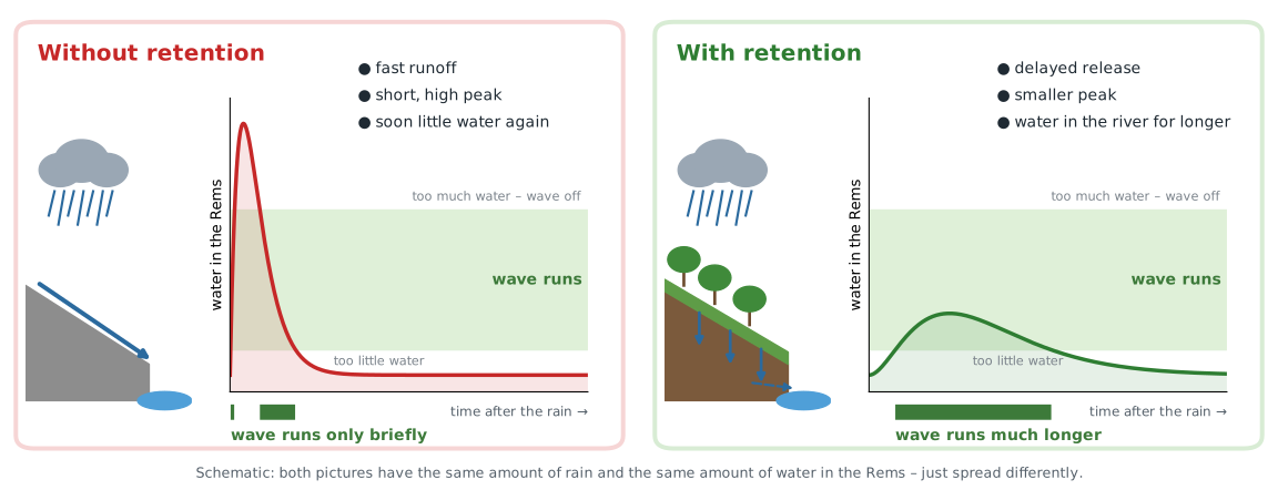
+15 to +23 surf days a year – that is what our calculation shows if the landscape in the catchment held back a fifth of the fast runoff for longer. A by-product of what is good for the valley anyway.
The site
Right beneath the bridge lies the outlet structure of a flood retention basin – locally called the "Remswehr" – with stepping stones and reinforced banks. The structure narrows the river and can impound it; to what extent this can provide the head for a surfable wave is for the feasibility study to establish. We are examining two variants: a focused wave directly at the weir and a wider wave with a larger usable area ("more flow") at the stepping stones.
The existing structure could gain a dual function; no new site on undeveloped land would be needed. Flood protection must not be impaired – that is a precondition for any further planning.
The project and the siteMore than a wave
Most people will never stand on the wave. A Remswelle could still benefit everyone – a place by the water where people like to stay.
A place to watch and linger for all generations – at the waves in Nuremberg and Hanover you see spectators, families and cyclists on the banks.
At a glance →A trend sport that can be especially attractive to young people – exercise outdoors by the river.
Children and young people →Clean-ups and care days on the banks of the Rems make responsibility for the river tangible.
Support us →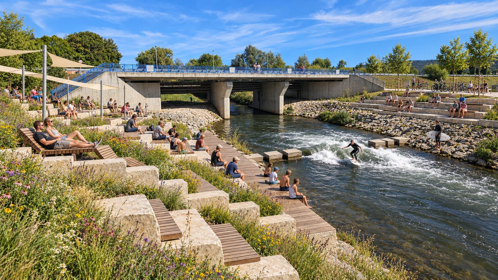
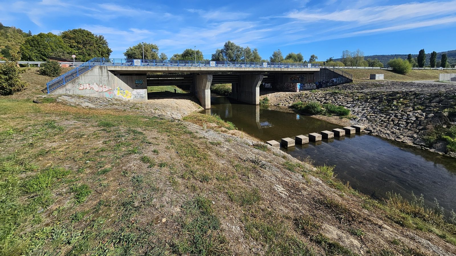 Visualisation – idea sketch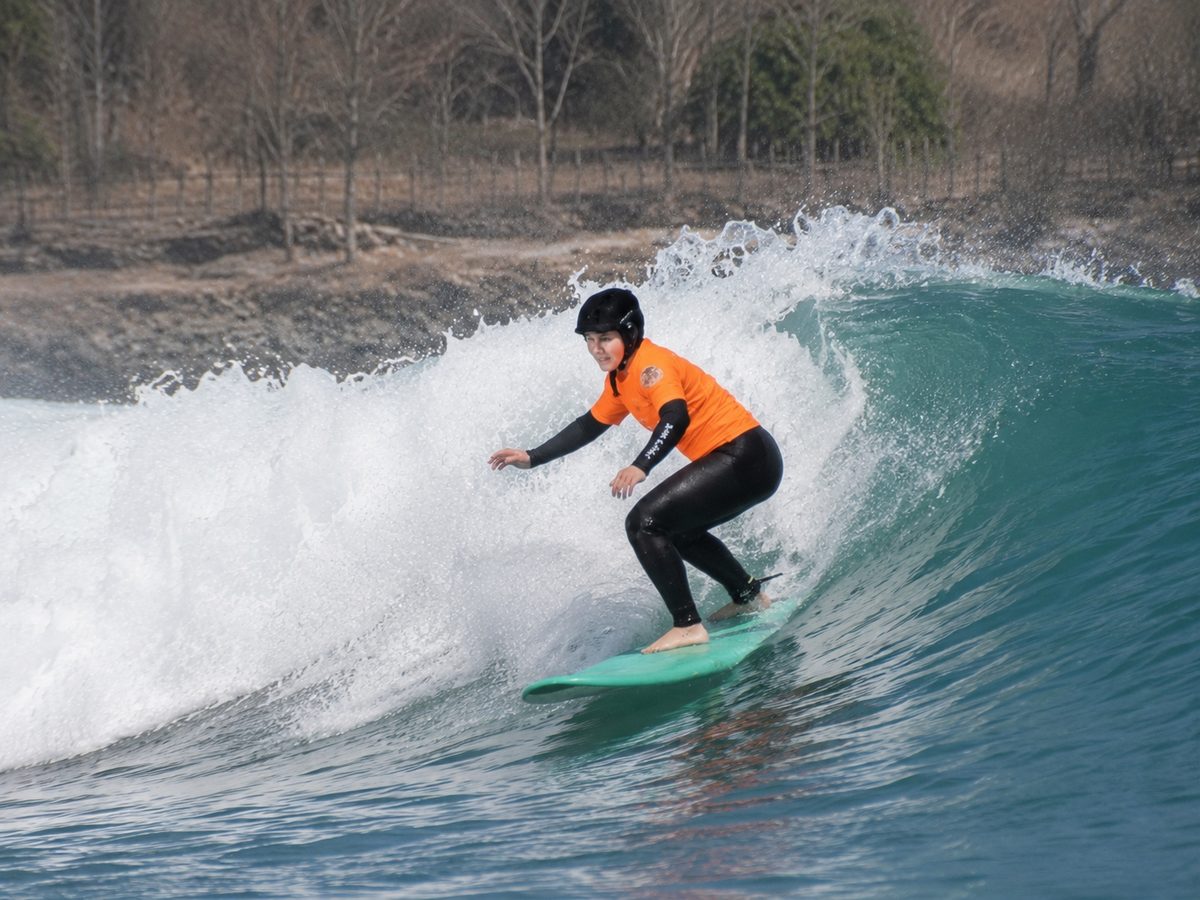
Wave logic
When fast water suddenly meets slower water, a hydraulic jump forms – the water breaks like an ocean wave but stays in place. Whether this happens is decided by the Froude number, the ratio of flow velocity to water depth.
In the Rems, the natural current is not enough for this on most days. Impoundment, constriction or ramps can help – that is exactly what we are examining.
Hydraulics explainedNew here?
Try it yourself
Drag a slider, click through the steps, switch layers on and off: with these maps anyone can see for themselves how the Rems used to flow, where it goes in a flood and how Winterbach has grown.
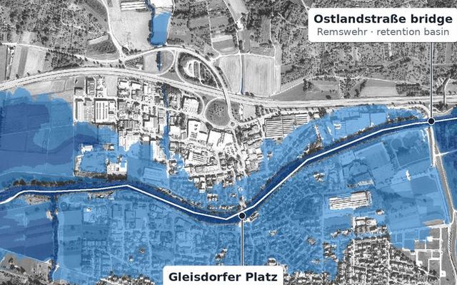
How far the Rems spills over its banks from a ten-year flood to an extreme flood – with and without the retention basin.
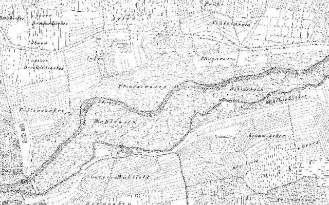
The 1832 cadastral map over today's aerial photo: drag the slider to see the old Rems with its mill canal.
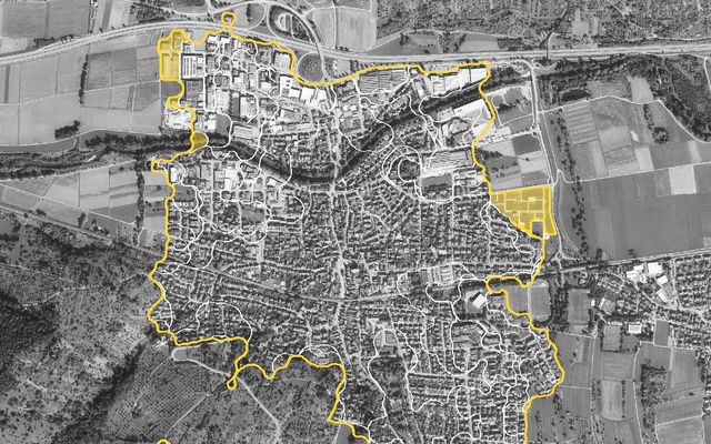
Seven aerial photos from 1953 to today: how the village grew into the valley and up the slopes.
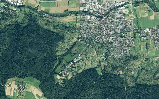
Field names, streams, springs, protected areas and development plans to switch on and off – with search.
Cool nights · Restoration before/after · Riverside paths · Field-name map · All journeys of discovery →
River waves
What we learn on the way to the Remswelle, we share: from hydraulics to permits and ecology, costs, operators and the experience of other waves in Germany, Austria and Switzerland.
Rems and Winterbach
If you want a wave in the Rems, you have to know the river: how much water it carries today, how it used to flow, what lives in it and where its water comes from. We bring this together – with maps, our own analyses and sources.
Why this matters for the wave: More flow for the Rems →
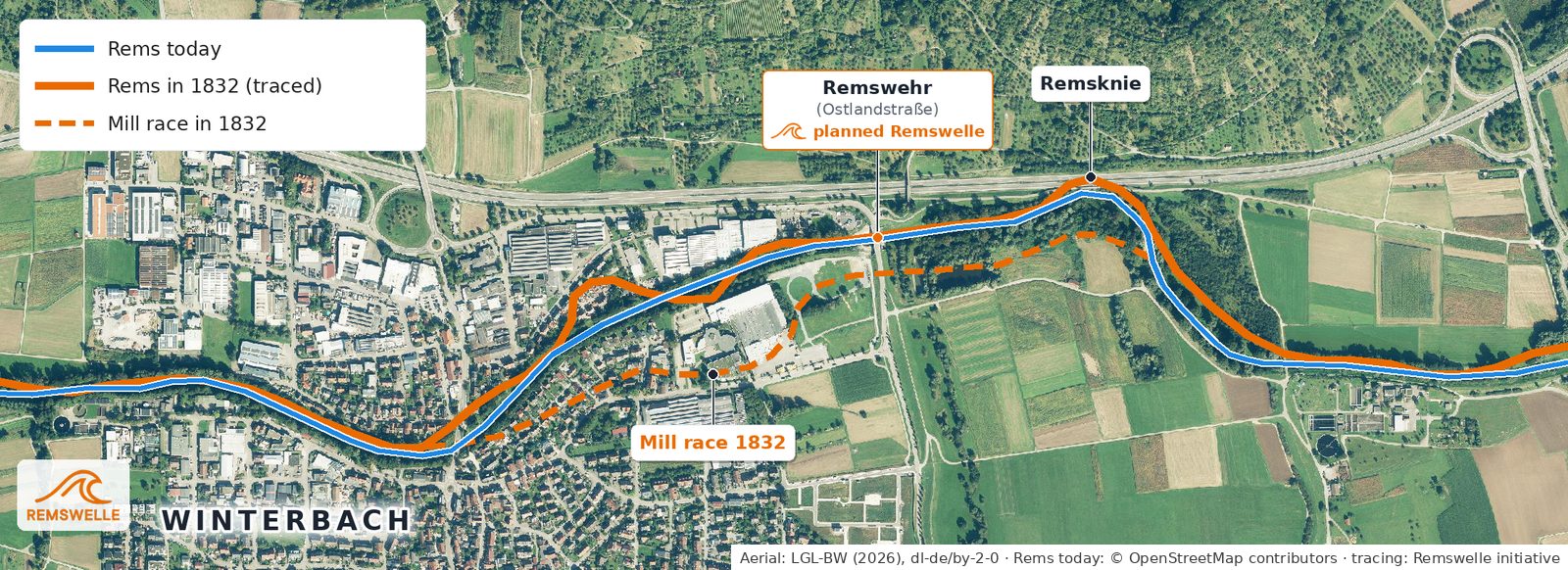 Time travel: how the Rems flowed in 1832 – compared with today →
Follow the raindrop: gauges, streams, soils, heavy rain and dry summers.
Journey: water →Barbel, kingfisher, beaver, open slopes – and where the cool night air comes from.
Journey: nature and climate →The 1832 field map, terrain model, aerial photos – and what they reveal about the valley.
Journey: history →The Rems today: how much water is flowing → · All five journeys of discovery →
Every name counts and helps us in talks with authorities and funders. Sign up – it takes a minute.
I support the RemswelleIn the press
The local newspaper Schorndorfer Nachrichten (Zeitungsverlag Waiblingen) presented the idea in May 2025: a man-made wave in the Rems, modelled on Munich's Eisbach.
Read the article at zvw.de (opens in a new tab) (Reinhold Manz, 18 May 2025; in German, paywall) · Press information and fact sheet