
Rems and Winterbach · River, water, nature and history
Springs and hillside water in Winterbach
It is not only the Rems that shapes the valley at Winterbach. Water comes from both sides of the valley: from springs on the Schurwald to the south and on the Hungerberg to the north, via streams, ditches and the groundwater into the Rems floodplain. As early as 1851 the official description of the Oberamt (district) of Schorndorf stated: "Winterbach hat das beste Quellwasser im Remsthal." (Winterbach has the best spring water in the Rems valley.) Here we explain where this water comes from, where it shows itself and what is documented – and what is not.
The Schurwald side: "reich an immer fließenden Quellen"
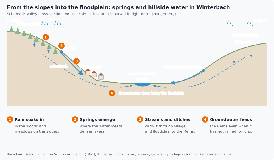
Winterbach lies mostly south of the Rems, at the foot of the Schurwald. The 1851 Oberamt description records: "Überhaupt ist die Schurwaldseite reich an immer fließenden Quellen." (In general the Schurwald side is rich in ever-flowing springs.) As an example it names the Lehenbach – spelt “Lehnenbach” in the source –, which flows "vom Schurwalde her" (from the Schurwald) through the village as a "nie vertrocknende[r]" (never drying-up) stream and at that time formed a small fire pond. Two wells in the village are singled out for particular praise, the Etscheter and the Weiherbrunnen. Today the Lehenbach flows culverted beneath the main road through the village and joins the Rems below the "Remswehr" (as it is called locally). → Tributaries of the Rems
The north side: Hungerberg and Pfaffenbrunnen
Opposite, "jenseits der Rems" (on the other side of the Rems), as the 1851 text puts it, lie the vineyard slopes – the sites Wanne, Altenberg and Pfaffenbronn and above them the Hungerberg. Here, too, there is water. The field name Pfaffenbronn gives it away: "Bronn bedeutet Brunnen (Quelle)" (Bronn means well (spring)), explains the municipality's walking brochure. According to the Heimatverein Winterbach (local history society), the water of the Pfaffenbrunnen also served the farmers and wine growers as drinking water; a second well, the Muggabrünnele, supplied the Hof, Wanne and Hungerberg areas. Today the Obstbauring (fruit growers' association) uses the overflow of the spring for its teaching garden. The biotope survey of the state lists a "Quelle im Gewann Pfaffenbronn" (spring in the Pfaffenbronn area) as a protected biotope.
On the cultural history trails around the Hungerberg, the Heimatverein shows how people used and directed the hillside water: captured springs and watering places, drainage ditches between the vineyards. These include the spring by the Homöopathenhäusle: it feeds the stream of the Höffenklinge, which joins the Rems above the Ostlandstraße bridge. → Wildlife and plants on the Rems
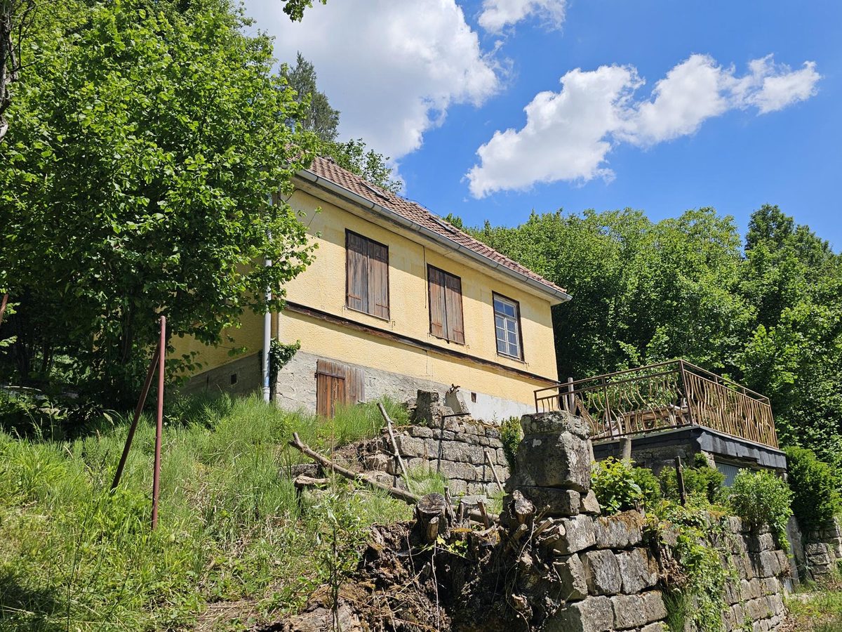
The Homöopathenhäusle in the Höffenklinge
What people sought at the Höffenklinge in 1930 – cool air, water, a view – the state's climate atlas describes today in terms of cold-air corridors and compensation areas. → Cool air for Winterbach · → Traces in the Hungerberg
From the slope into the floodplain
How rain becomes spring water is in principle the same on both sides of the valley. Rain seeps into woodland, meadows and vineyards. In the ground the water flows slowly downhill until it meets denser layers and emerges at the surface – as a spring, as a wet patch on the slope or in a ditch. Streams and ditches carry it into the valley floodplain. There the groundwater lies close beneath the surface and is connected to the river.
This matters for the Rems too: when it does not rain for weeks, the river lives almost entirely on this groundwater and the springs in its catchment. In late summer 2026 it was below one cubic metre per second at the Schorndorf gauge on many days. → The Rems in figures
Why the floodplain is wet in places
If you walk through the Rems floodplain, you see places with reeds, wet meadows and ditches. Old field names fit this: the Württemberg cadastral map (Flurkarte) of 1832 for Weiler and Winterbach names, among others, the fields Altlachen, Riedwiesen and Breitwiesen – "Ried" stands for wet land, often overgrown with reeds, a "Lache" for a pool of water. Such names show how people experienced and used the land at the time.
Why a place is wet today, however, can have various reasons: spring and hillside water from the edge of the valley, groundwater close to the surface, hollows in which water collects, ditches – or an old channel of the Rems. Which explanation is right in each case can only be settled with terrain data and old maps.
→ Time travel: the historic course of the Rems at Winterbach
Hillside water, heavy rain and floods
Spring and hillside water flows constantly and mostly unnoticed. Heavy rain is something else: then so much water runs off the slopes over paths and roads in a short time that it can flood cellars and streets. Since December 2024 the municipality of Winterbach has had heavy-rain hazard maps for this, which show where water collects during extreme rain and how fast it flows. And Rems floods come from somewhere else again: from the whole catchment upstream. → Flood protection on the Rems
What this means for the Remswelle
For the amount of water a wave has, springs and hillside streams in Winterbach play hardly any role – most of them join below the site, and the Rems brings its water from far upstream. But they explain why the floodplain is the way it is, and why there is so much life here. Anyone who builds a wave on the Rems builds it into a water landscape that has been used and changed over centuries – and that deserves to be known. → The Rems through time · → The Winterbach site
Frequently asked questions
Does Winterbach have particularly good spring water?
The 1851 description of the Oberamt of Schorndorf says: "Winterbach hat das beste Quellwasser im Remsthal" (Winterbach has the best spring water in the Rems valley), with the Etscheter and the Weiherbrunnen being particularly good. This says nothing about today's drinking water supply.
What is the Pfaffenbrunnen in Winterbach?
A spring in the Pfaffenbronn area on the vineyard slope north of the Rems. Its water used to serve farmers and wine growers as drinking water; today the Obstbauring uses the overflow for its teaching garden. The state lists it as a protected biotope.
Where does the water in the slopes come from?
From rain that seeps into woodland, meadows and vineyards and flows downhill in the ground until it emerges as a spring or reaches the groundwater of the floodplain.
Did the Rems once flow through the wet meadows?
That is not documented. Field names such as Riedwiesen and Altlachen show a formerly wetter floodplain, but wet places can also come from springs, groundwater or ditches. This could only be settled with old maps and terrain data.
Sources: Homöopathischer Verein Winterbach und Umgebung e. V., chronicle of the association (hv-winterbach.de) · Heimatverein Winterbach e. V., "Gemeinschaftsarbeit", 07.03.2022 · Beschreibung des Oberamts Schorndorf (description of the Oberamt of Schorndorf), ed. by the Königlich statistisch-topographisches Bureau, Stuttgart 1851 (Wikisource), chapter B 27 (Winterbach) · Heimatverein Winterbach and Gemeinde Winterbach, information sheet and leaflet "Kulturgeschichtliche Wege um den Hungerberg"; Heimatverein Winterbach, "Brot und Wein in Winterbach", 11.07.2019 · Gemeinde Winterbach, brochure "Wandern in Winterbach" (2022) · Landesarchiv Baden-Württemberg, Staatsarchiv Ludwigsburg EL 68 VI Nr 2356, Flurkarte NO XXVIII 29 (cadastral map), as of 1832 (Weiler, Winterbach), via LEO-BW · LUBW, biotope survey (queried 26.09.2026) · Gemeinde Winterbach, Starkregengefahrenkarten (heavy-rain hazard maps) · Map data © OpenStreetMap contributors
Last updated: 15 October 2026 · Initiative Remswelle