
For comparison: Böhnlöchle and Höffenklinge
Rocks, soil and slope indications on two slopes of the Hungerberg
On the page Why slopes slide we show the landslide area on the south-west slope of the Hungerberg. Here is the same analysis for two more slopes that often appear on our pages: the Böhnlöchle at the western end of the Hungerberg and the Höffenklinge in the east. The basis is the same: the state terrain model, the geological map and the engineering-geological hazard indication map of the State Office for Geology, Raw Materials and Mining (LGRB), and its soil map. All maps are at a scale of 1:50,000 and are not accurate to the plot.
In short: Neither slope lies in a landslide area. The nearest one is a good half kilometre away in each case. In both sections, however, the State Office records a small "rockfall" spot on a steep edge.
Böhnlöchle
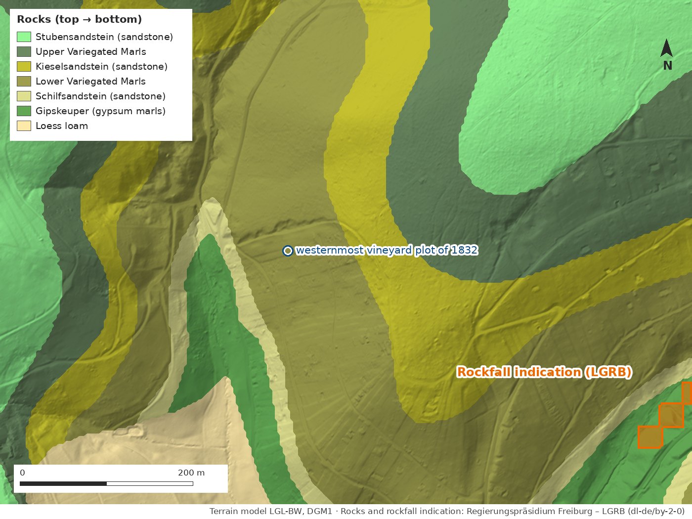
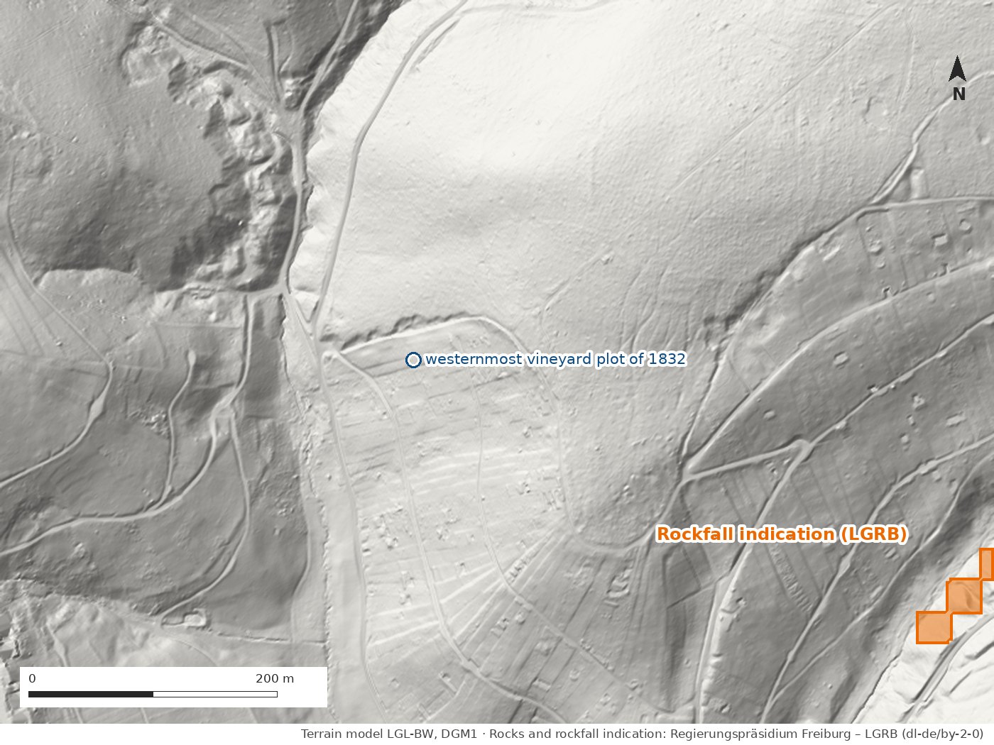
Rocks. The slope shows the same sequence of layers as the landslide area further east: Gipskeuper and Schilfsandstein at the bottom, above them the Lower Variegated Marls, the Kieselsandstein, the Upper Variegated Marls and the Stubensandstein on top. The westernmost vineyard plot of 1832 lies in the Lower Variegated Marls.
Slope indications. The map records no landslide area here; the nearest – the one on the Hungerberg – begins about half a kilometre to the south-east. At the south-east edge of the picture, a good 400 metres from the vineyard plot, there is a small "rockfall" indication on a steep slope edge. On average the section is about 16 degrees steep.
Soil. At the vineyard plot the soil map shows a boundary: downhill lies Rigosol – deeply trenched vineyard soil, calcareous and clayey-loamy with sandstone grit. Uphill, towards the forest edge, a pelosol brown earth from loess-bearing solifluction loam begins, mostly free of lime in the top metre. What this means for vines is explained on the page Vineyards of tomorrow.
Höffenklinge
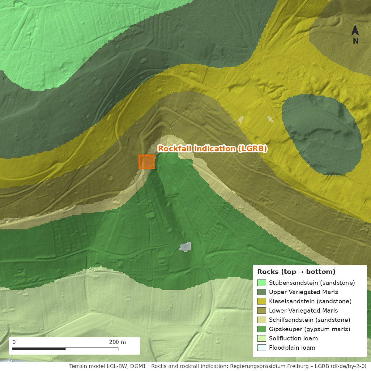
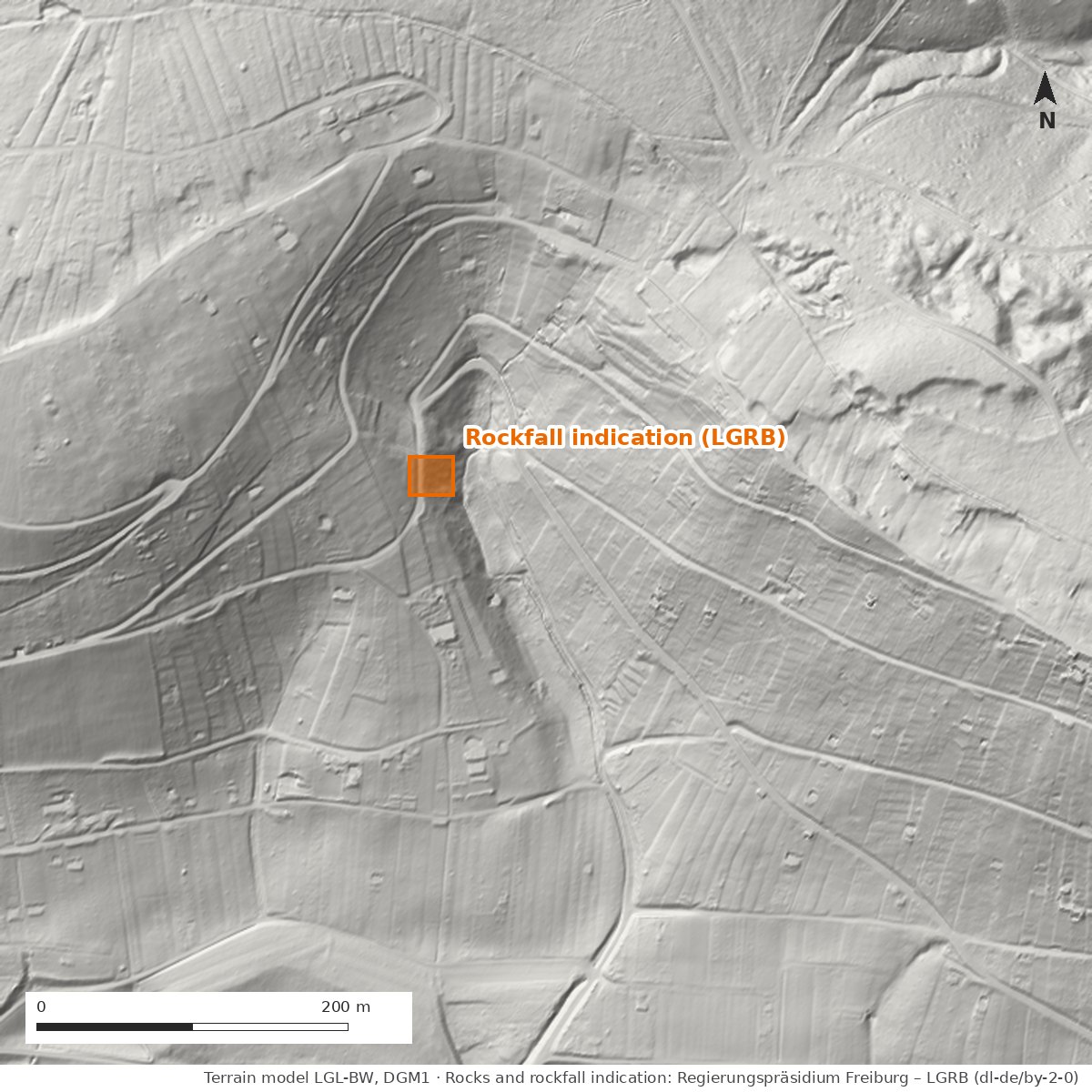
Rocks. The Höffenklinge has cut down from the Upper Variegated Marls through the Kieselsandstein and the Lower Variegated Marls into the Gipskeuper. At the bottom of the valley lies loess-bearing solifluction loam.
Slope indications. Here, too, the map records no landslide area; the nearest is about 600 metres away. The "rockfall" indication sits at the upper end of the ravine, where the cut is steepest. On average the section is about 17 degrees steep.
Soil. The slope is mostly covered by Rigosol – here, too, a sign of old vineyards –, above it towards the plateau pelosol brown earth, at the bottom of the valley luvisol from loess-bearing solifluction loam.
What the indications mean
A "rockfall" indication means: stones or blocks of rock can come loose at this spot, typically on steep edges of sandstone beds or old quarry faces. As with the landslide areas, this is a first assessment at a scale of 1:50,000, not a danger level and not related to individual properties. What the map shows for landslide areas and what it does not is explained on the page Why slopes slide.
Sources: Data source: Regierungspräsidium Freiburg – LGRB: engineering-geological hazard indication map 1:50,000 (IGHK50; landslide areas, rockfall), geological map (GeoLa), soil map 1:50,000 (BK50, map units L262 and L533 with descriptions), retrieved 14.10.2026, Data licence Germany – attribution 2.0 · Terrain model LGL-BW, DGM1 (dl-de/by-2-0) · Vineyards 1832: first survey map, own digitisation · Analysis and illustration: Initiative Remswelle
Last updated: 15 October 2026 · Initiative Remswelle